
Trekking in Nepal
Treks in Nepal
Great walks of the Himalaya, each with its own page: the route day by day, where you sleep, the best seasons and set departures, and a 3D map of the whole trail on real elevation data.
Compare the treks
The treks are grouped by region. Choose regions to narrow the list, or tick treks from any regions to compare just those.
| Trek | Difficulty | Usually | Highest point | Starts at | Best seasons | From, per person |
|---|---|---|---|---|---|---|
| Everest region 4 treks | ||||||
| Everest Base Camp | Demanding | 12–14 days | Kala Patthar5,644 m (18,517 ft) | Lukla | Mar–May Oct–Nov | £1,280 |
| Gokyo Lakes | Demanding | 12–14 days | Gokyo Ri5,357 m (17,575 ft) | Lukla | Mar–May Oct–Nov | £1,250 |
| Everest Three Passes | Very demanding | 18–21 days | Kongma La5,535 m (18,159 ft) | Lukla | Apr–May Oct–Nov | £1,700 |
| Everest Panorama | Moderate | 7–9 days | Everest View Hotel3,880 m (12,730 ft) | Lukla | Mar–May Oct–Dec | £880 |
| Annapurna region 4 treks | ||||||
| Annapurna Base Camp | Moderate | 7–12 days | Base camp4,130 m (13,550 ft) | Nayapul | Mar–May Oct–Nov | £750 |
| Mardi Himal | Moderate | 7–9 days | Base camp4,500 m (14,764 ft) | Kande | Mar–May Oct–Nov | £650 |
| Annapurna Circuit | Demanding | 12–16 days | Thorong La5,416 m (17,769 ft) | Dharapani | Mar–May Oct–Nov | £1,020 |
| Ghorepani Poon Hill | Easy | 6–8 days | Poon Hill3,210 m (10,531 ft) | Nayapul | Mar–May Oct–Dec | £540 |
| Langtang region 2 treks | ||||||
| Langtang Valley | Moderate | 7–10 days | Tserko Ri (optional)4,984 m (16,352 ft) | Syabrubesi | Mar–May Oct–Nov | £620 |
| Gosaikunda | Moderate | 5–7 days | Gosaikunda4,380 m (14,370 ft) | Dhunche | Mar–May Oct–Nov | £490 |
| Manaslu region 2 treks | ||||||
| Manaslu Circuit | Demanding | 14–17 days | Larkya La5,106 m (16,752 ft) | Machha Khola | Mar–May Sep–Nov | £1,520 |
| Tsum Valley | Moderate | 12–15 days | Mu Gompa3,700 m (12,139 ft) | Machha Khola | Mar–May Sep–Nov | £1,480 |
| Mustang region 1 trek | ||||||
| Upper Mustang | Moderate | 12–15 days | Chogo Laabout 4,200 m (13,780 ft) | Jomsom | Mar–Nov | £2,280 |
| Dolpo region 1 trek | ||||||
| Lower Dolpo | Very demanding | 16–19 days | Numa La5,190 m (17,028 ft) | Juphal | May–Jun Sep–Oct | £2,560 |
| Kanchenjunga region 1 trek | ||||||
| Kanchenjunga Base Camp | Very demanding | 18–22 days | Pangpema5,143 m (16,873 ft) | Sekathum | Mar–May Oct–Nov | £2,700 |
Side by side
Everything that tells these treks apart, from how hard they are to what they cost. Heights and distances are measured on the map; days, prices and dates are for our trips.
| What | Everest regionEverest Base Camp | Annapurna regionAnnapurna Base Camp | Annapurna regionMardi Himal | Annapurna regionAnnapurna Circuit | Dolpo regionLower Dolpo | Everest regionGokyo Lakes | Everest regionEverest Three Passes | Everest regionEverest Panorama | Annapurna regionGhorepani Poon Hill | Langtang regionLangtang Valley | Langtang regionGosaikunda | Manaslu regionManaslu Circuit | Manaslu regionTsum Valley | Mustang regionUpper Mustang | Kanchenjunga regionKanchenjunga Base Camp |
|---|---|---|---|---|---|---|---|---|---|---|---|---|---|---|---|
| At a glance | |||||||||||||||
| Difficulty | Demanding | Moderate | Moderate | Demanding | Very demanding | Demanding | Very demanding | Moderate | Easy | Moderate | Moderate | Demanding | Moderate | Moderate | Very demanding |
| Who it suits | Fit walkers ready for altitude; no experience needed | First-time trekkers who are fit; no altitude experience needed | Walkers short of time who want a quieter ridge and a high view | Fit walkers who want a big pass and changing country | Experienced trekkers happy to camp, far from help | Fit walkers who want Everest views without the crowds | Experienced trekkers who have been to altitude before | Families, first-timers and anyone short of time | First-timers, families and walkers of most ages | Walkers who want big mountains close to Kathmandu without a flight | Walkers with a few days who want a high lake and a pilgrim trail | Fit walkers, ideally with some trekking experience | Walkers more interested in culture than a high pass | Walkers who want culture and desert landscapes, even in the monsoon | Experienced trekkers who want somewhere truly remote |
| How long | 12–14 daysOur trip: 14 days, Kathmandu to Kathmandu | 7–12 daysOur trip: 10 days, Kathmandu to Kathmandu | 7–9 daysOur trip: 9 days, Kathmandu to Kathmandu | 12–16 daysOur trip: 13 days, Kathmandu to Kathmandu | 16–19 daysOur trip: 18 days, Kathmandu to Kathmandu | 12–14 daysOur trip: 13 days, Kathmandu to Kathmandu | 18–21 daysOur trip: 20 days, Kathmandu to Kathmandu | 7–9 daysOur trip: 8 days, Kathmandu to Kathmandu | 6–8 daysOur trip: 8 days, Kathmandu to Kathmandu | 7–10 daysOur trip: 9 days, Kathmandu to Kathmandu | 5–7 daysOur trip: 6 days, Kathmandu to Kathmandu | 14–17 daysOur trip: 14 days, Kathmandu to Kathmandu | 12–15 daysOur trip: 13 days, Kathmandu to Kathmandu | 12–15 daysOur trip: 14 days, Kathmandu to Kathmandu | 18–22 daysOur trip: 20 days, Kathmandu to Kathmandu |
| Price from | £1,280 per personOn your own: £1,650 | £750 per personOn your own: £1,020 | £650 per personOn your own: £880 | £1,020 per personOn your own: £1,350 | £2,560 per personOn your own: £3,300 | £1,250 per personOn your own: £1,600 | £1,700 per personOn your own: £2,150 | £880 per personOn your own: £1,150 | £540 per personOn your own: £720 | £620 per personOn your own: £820 | £490 per personOn your own: £640 | £1,520 per personOn your own: £1,980 | £1,480 per personOn your own: £1,920 | £2,280 per personOn your own: £2,940 | £2,700 per personOn your own: £3,480 |
| Best seasons | Mar–May · Oct–Nov | Mar–May · Oct–Nov | Mar–May · Oct–Nov | Mar–May · Oct–Nov | May–Jun · Sep–Oct | Mar–May · Oct–Nov | Apr–May · Oct–Nov | Mar–May · Oct–Dec | Mar–May · Oct–Dec | Mar–May · Oct–Nov | Mar–May · Oct–Nov | Mar–May · Sep–Nov | Mar–May · Sep–Nov | Mar–Nov | Mar–May · Oct–Nov |
| Altitude | |||||||||||||||
| Profile | |||||||||||||||
| Highest point | Kala Patthar, 5,644 m (18,517 ft) | Base camp, 4,130 m (13,550 ft) | Base camp, 4,500 m (14,764 ft) | Thorong La, 5,416 m (17,769 ft) | Numa La, 5,190 m (17,028 ft) | Gokyo Ri, 5,357 m (17,575 ft) | Kongma La, 5,535 m (18,159 ft) | Everest View Hotel, 3,880 m (12,730 ft) | Poon Hill, 3,210 m (10,531 ft) | Tserko Ri (optional), 4,984 m (16,352 ft) | Gosaikunda, 4,380 m (14,370 ft) | Larkya La, 5,106 m (16,752 ft) | Mu Gompa, 3,700 m (12,139 ft) | Chogo La, about 4,200 m (13,780 ft) | Pangpema, 5,143 m (16,873 ft) |
| Highest night | Gorak Shep, 5,164 m (16,942 ft) | Annapurna Base Camp, 4,130 m (13,550 ft) | High Camp, 3,580 m (11,745 ft) | Thorong Phedi, 4,450 m (14,600 ft) | Pelung Tang, 4,465 m (14,649 ft) | Gokyo, 4,790 m (15,715 ft) | Gorak Shep, 5,164 m (16,942 ft) | Tengboche, 3,867 m (12,687 ft) | Ghorepani, 2,860 m (9,383 ft) | Kyanjin Gompa, 3,870 m (12,697 ft) | Gosaikunda, 4,380 m (14,370 ft) | Dharamsala, 4,460 m (14,633 ft) | Mu Gompa, 3,700 m (12,139 ft) | Ghar Gompa, 3,950 m (12,959 ft) | Pangpema, 5,143 m (16,873 ft) |
| Nights at 4,000 m or above | 5 | 1 | None | 2 | 6 | 5 | 10 | None | None | None | 1 | 1 | None | None | 6 |
| Altitude sickness risk | HighFrom the highest night. Anyone can be affected above about 2,500 m | ModerateFrom the highest night. Anyone can be affected above about 2,500 m | ModerateFrom the highest night. Anyone can be affected above about 2,500 m | HighFrom the highest night. Anyone can be affected above about 2,500 m | HighFrom the highest night. Anyone can be affected above about 2,500 m | HighFrom the highest night. Anyone can be affected above about 2,500 m | HighFrom the highest night. Anyone can be affected above about 2,500 m | ModerateFrom the highest night. Anyone can be affected above about 2,500 m | LowFrom the highest night. Anyone can be affected above about 2,500 m | ModerateFrom the highest night. Anyone can be affected above about 2,500 m | HighFrom the highest night. Anyone can be affected above about 2,500 m | HighFrom the highest night. Anyone can be affected above about 2,500 m | ModerateFrom the highest night. Anyone can be affected above about 2,500 m | ModerateFrom the highest night. Anyone can be affected above about 2,500 m | HighFrom the highest night. Anyone can be affected above about 2,500 m |
| The route | |||||||||||||||
| Route | Lukla → Namche Bazaar → Tengboche → Dingboche → Lobuche → Everest Base Camp | Nayapul → Ghandruk → Chhomrong → Deurali → Machapuchare Base Camp → Annapurna Base Camp | Kande → Australian Camp → Forest Camp → Low Camp → Upper View Point → Mardi Himal Base Camp | Dharapani → Upper Pisang → Manang → Thorong Phedi → Thorong La → Jomsom | Juphal → Laini → Dho Tarap → Numa La → Baga La → Chhepka → Juphal | Lukla → Phakding → Namche Bazaar → Dole → Machhermo → Gokyo | Lukla → Tengboche → Kongma La → Cho La → Renjo La → Namche Bazaar → Lukla | Lukla → Phakding → Namche Bazaar → Khumjung → Tengboche | Nayapul → Tikhedhunga → Ulleri → Ghorepani → Poon Hill | Syabrubesi → Lama Hotel → Ghoda Tabela → Langtang → Kyanjin Gompa | Dhunche → Chandanbari → Laurebina → Gosaikunda | Machha Khola → Deng → Lho → Dharamsala → Bimthang → Dharapani | Machha Khola → Jagat → Lokpa → Chhokangparo → Nile → Mu Gompa | Jomsom → Kagbeni → Chele → Ghami → Tsarang → Lo Manthang | Sekathum → Amjilosa → Gyabla → Kambachen → Lhonak → Pangpema |
| Shape | Up and backThe walk out takes three or four days, back down the same valley to Lukla. | Up and backThe walk out takes three or four days back down the gorge, with a stop at the hot springs at Jhinu. | Up and backThe walk out takes a day and a half, back down the ridge and east through the villages to Sidhing and the road to Pokhara. | One way, over a passFrom Jomsom a short flight down the Kali Gandaki gorge, often called the deepest in the world, brings you to Pokhara. | A loopFrom Juphal the morning flight goes back to Nepalgunj, and on to Kathmandu. | Up and backThe walk out takes three days, back down the valley to Namche and Lukla. | A loopFrom Lukla the morning flight takes you back to Kathmandu. | Up and backThe walk out takes two days, back to Namche and down to Lukla. | Up and backThe walk out takes two or three days, along the ridge to Tadapani and down through Ghandruk to the road. | Up and backThe walk out takes two days, back down the valley to Syabrubesi and the road to Kathmandu. | Up and backThe walk out takes two days, back down the ridge to Dhunche and the road. | One way, over a passFrom Dharapani a jeep takes you down the Marsyangdi to Besisahar and on by road to Kathmandu. | Up and backThe walk out takes four days, back down the valley and the Budhi Gandaki to the road. | Up and backThe way back follows a different path, west past Ghar Gompa and Dhakmar, then by jeep down the Kali Gandaki to Jomsom. | Up and backThe walk out takes five or six days, back down the Ghunsa valley to Sekathum and the road. |
| Walking distance | About 48.8 km to the topwith about 3,138 m of climbing | About 41.4 km to the topwith about 3,836 m of climbing | About 25.2 km to the topwith about 2,858 m of climbing | About 92.4 km start to finishwith about 5,049 m of climbing | About 143.6 km round the loopwith about 5,774 m of climbing | About 36.5 km to the topwith about 2,452 m of climbing | About 117.8 km round the loopwith about 5,606 m of climbing | About 26 km to the topwith about 1,770 m of climbing | About 18.2 km to the topwith about 2,177 m of climbing | About 26.3 km to the topwith about 2,243 m of climbing | About 16.8 km to the topwith about 2,422 m of climbing | About 110.5 km start to finishwith about 5,467 m of climbing | About 60 km to the topwith about 3,788 m of climbing | About 58.4 km to the topwith about 2,310 m of climbing | About 48.8 km to the topwith about 3,446 m of climbing |
| A usual walking day | 5–7 hours | 5–7 hours | 5–7 hours | 5–7 hours | 6–8 hours | 5–7 hours | 6–8 hours | 4–6 hours | 4–6 hours | 5–6 hours | 5–7 hours | 6–8 hours | 5–7 hours | 6–7 hours | 6–8 hours |
| The hardest part | Lobuche to Gorak Shep and on to base camp, above 5,000 m, then Kala Patthar before dawn | The stone steps above and below Chhomrong, and the climb from Deurali to base camp | The dawn climb from High Camp to base camp and back, about 1,000 m up and down | The Thorong La: a pre-dawn start, about 1,000 m up to 5,416 m, then 1,600 m down to Muktinath | Numa La and Baga La, two passes over 5,100 m on consecutive days | The dawn climb of Gokyo Ri, to 5,357 m, then the long walk down to Dole | Each pass is a long day of 8 to 10 hours; Kongma La, at 5,535 m, is the highest | The long, steep climb from the river to Namche Bazaar | The stone staircase of about 3,300 steps up to Ulleri | The optional climb of Tserko Ri, to 4,984 m and back in a day | The steep climb from Dhunche to Sing Gompa, and the height gained in three days | The Larkya La: 10 hours or more from Dharamsala over 5,106 m and down to Bimthang | The long, steep days in the Budhi Gandaki gorge | Long, windy days over passes of about 3,800 to 4,200 m | The days from Lhonak to Pangpema and back, near 5,000 m, after nearly two weeks of walking |
| Getting there | |||||||||||||||
| Start | Lukla | Nayapul, near Pokhara | Kande, near Pokhara | Dharapani, by road from Besisahar | Juphal | Lukla | Lukla | Lukla | Nayapul, near Pokhara | Syabrubesi, by road from Kathmandu | Dhunche, by road from Kathmandu | Machha Khola, by road from Kathmandu | Machha Khola, by road from Kathmandu | Jomsom, by air from Pokhara | Sekathum, by road from Taplejung |
| Getting there and back | Flight Kathmandu to Lukla, about 35 minutes; in the busy seasons often from Ramechhap, a few hours by road | Bus or short flight to Pokhara, then about 1½ hours by road to the trailhead | Bus or short flight to Pokhara, then about an hour by road to Kande; jeep back from Sidhing | By road to Besisahar and jeep to Dharapani; flight Jomsom to Pokhara at the end | Flight to Nepalgunj, then a small plane to Juphal, about 45 minutes, both ways | Flight Kathmandu to Lukla, about 35 minutes; in the busy seasons often from Ramechhap | Flight Kathmandu to Lukla, about 35 minutes; in the busy seasons often from Ramechhap | Flight Kathmandu to Lukla, about 35 minutes; in the busy seasons often from Ramechhap | Bus or short flight to Pokhara, then about 1½ hours by road to the trailhead | By road from Kathmandu to Syabrubesi, about 7 hours each way | By road from Kathmandu to Dhunche, about 6 to 7 hours each way | By road to Machha Khola, a long day; jeep from Dharapani at the end | By road to Machha Khola and back, a long day each way | Bus or flight to Pokhara, flight to Jomsom, about 20 minutes; jeep back down the valley | Flight to Bhadrapur, a long day by road to Taplejung, then a jeep to the trailhead; the same way back |
| Weather delays | High: mountain flights are often delayed or cancelled | Low: the start is reached by road | Low: the start is reached by road | Some: roads, or a short mountain flight, can be held up | High: mountain flights are often delayed or cancelled | High: mountain flights are often delayed or cancelled | High: mountain flights are often delayed or cancelled | High: mountain flights are often delayed or cancelled | Low: the start is reached by road | Some: roads, or a short mountain flight, can be held up | Some: roads, or a short mountain flight, can be held up | Some: roads, or a short mountain flight, can be held up | Some: roads, or a short mountain flight, can be held up | Some: roads, or a short mountain flight, can be held up | Some: roads, or a short mountain flight, can be held up |
| On the trail | |||||||||||||||
| Where you sleep | Teahouses all the way, twin rooms | Teahouses all the way, twin rooms; shared rooms high up in October | Small teahouses, simple and cold above Forest Camp | Teahouses all the way, twin rooms | Mostly camping with a cook and crew; simple lodges in the bigger villages | Teahouses all the way, twin rooms | Teahouses all the way, small and basic at Dzongla and Lungden | Teahouses all the way, twin rooms | Teahouses all the way, twin rooms | Teahouses all the way, twin rooms | Teahouses, simple at the lake | Teahouses all the way, simpler than on the Annapurna Circuit | Homestays and small lodges | Family lodges all the way | Basic teahouses, with camping on some nights |
| How busy | Busy, above all in October and April | Busy in spring and autumn | Moderate, busier each year | Busy in October; quieter in spring | Very quiet | Quieter than the Everest Base Camp trail | Busy at base camp, quiet on the passes | Busy on the main trail | Busy, above all at sunrise on Poon Hill | Moderate | Moderate; very busy at the Janai Purnima festival | Moderate, quieter than the Annapurna Circuit | Quiet | Quiet; busy in Lo Manthang at the Tiji festival | Very quiet |
| Wi-Fi, charging, signal | Paid Wi-Fi in most villages, weaker higher up; charging costs extra | Wi-Fi in most lodges, weaker high up; charging usually costs extra | Patchy phone signal on the ridge; Wi-Fi in some lodges | Wi-Fi in most villages; signal patchy near the pass | Little or no Wi-Fi or signal for days; bring a power bank | Paid Wi-Fi in most villages; charging costs extra | Paid Wi-Fi in most villages; little at the foot of the passes | Paid Wi-Fi in most villages; charging costs extra | Wi-Fi and signal in most villages | Wi-Fi in most lodges; signal patchy in the gorge | Patchy signal; Wi-Fi in some lodges | Patchy; little signal in the upper valley | Little Wi-Fi or signal in the upper valley | Wi-Fi in some lodges, above all in Lo Manthang; signal patchy | Little Wi-Fi or signal above Ghunsa |
| Permits and rules | |||||||||||||||
| Permits | A Sagarmatha National Park entry permit and the Khumbu Pasang Lhamu Rural Municipality permit. | The Annapurna Conservation Area Permit (ACAP), and any trekker registration required at the time. | The Annapurna Conservation Area Permit (ACAP), and any trekker registration required at the time. | The Annapurna Conservation Area Permit (ACAP), and any trekker registration required at the time. | The Lower Dolpo restricted area permit and the Shey Phoksundo National Park entry permit. The restricted area permit is issued only through a licensed trekking agency, and only to trekkers walking with a licensed guide. | A Sagarmatha National Park entry permit and the Khumbu Pasang Lhamu Rural Municipality permit. | A Sagarmatha National Park entry permit and the Khumbu Pasang Lhamu Rural Municipality permit. | A Sagarmatha National Park entry permit and the Khumbu Pasang Lhamu Rural Municipality permit. | The Annapurna Conservation Area Permit (ACAP), and any trekker registration required at the time. | A Langtang National Park entry permit, and any trekker registration required at the time. | A Langtang National Park entry permit, and any trekker registration required at the time. | The Manaslu restricted area permit, the Manaslu Conservation Area Permit and the Annapurna Conservation Area Permit for the descent to Dharapani. The restricted area permit is issued only through a licensed agency, and only to trekkers walking with a licensed guide. | The Tsum Valley restricted area permit, the Manaslu restricted area permit for the stretch from Jagat to Lokpa, the Manaslu Conservation Area Permit and any trekker registration required at the time. The restricted area permit is issued only through a licensed agency, and only to trekkers walking with a licensed guide. | The Upper Mustang restricted area permit, which costs much more than most and is charged for each day inside the restricted area, and the Annapurna Conservation Area Permit. The restricted area permit is issued only through a licensed agency, and only to trekkers walking with a licensed guide. | The Kanchenjunga restricted area permit and the Kanchenjunga Conservation Area Permit. The restricted area permit is issued only through a licensed agency, and only to trekkers walking with a licensed guide. |
| Guide | Included with every booking | Included with every booking | Included with every booking | Included with every booking | Required by law (restricted area); included | Included with every booking | Included with every booking | Included with every booking | Included with every booking | Included with every booking | Included with every booking | Required by law (restricted area); included | Required by law (restricted area); included | Required by law (restricted area); included | Required by law (restricted area); included |
| On your own? | Yes: you walk with your guide and porter | Yes: you walk with your guide and porter | Yes: you walk with your guide and porter | Yes: you walk with your guide and porter | Yes: you walk with your guide and porter | Yes: you walk with your guide and porter | Yes: you walk with your guide and porter | Yes: you walk with your guide and porter | Yes: you walk with your guide and porter | Yes: you walk with your guide and porter | Yes: you walk with your guide and porter | Yes: you walk with your guide and porter | Yes: you walk with your guide and porter | Yes: you walk with your guide and porter | Yes: you walk with your guide and porter |
| Insurance | Must cover trekking to 5,700 m, with rescue | Must cover trekking to 4,200 m, with rescue | Must cover trekking to 4,600 m, with rescue | Must cover trekking to 5,500 m, with rescue | Must cover trekking to 5,500 m, with rescue | Must cover trekking to 5,500 m, with rescue | Must cover trekking to 5,700 m, with rescue | Must cover trekking to 4,000 m, with rescue | Must cover trekking, with rescue | Must cover trekking to 5,000 m, with rescue | Must cover trekking to 4,500 m, with rescue | Must cover trekking to 5,500 m, with rescue | Must cover trekking to 4,000 m, with rescue | Must cover trekking, with rescue | Must cover trekking to 5,500 m, with rescue |
| Booking | |||||||||||||||
| Included on this trek |
|
|
|
|
|
|
|
|
|
|
|
|
|
|
|
| Next departures | |||||||||||||||
| Book it | BookDay by day · 3D map | BookDay by day · 3D map | BookDay by day · 3D map | BookDay by day · 3D map | BookDay by day · 3D map | BookDay by day · 3D map | BookDay by day · 3D map | BookDay by day · 3D map | BookDay by day · 3D map | BookDay by day · 3D map | BookDay by day · 3D map | BookDay by day · 3D map | BookDay by day · 3D map | BookDay by day · 3D map | BookDay by day · 3D map |
The treks by region
Everest region
The Khumbu: a flight to Lukla, Sherpa villages and the highest mountains on Earth.
-
Khumbu · Solukhumbu
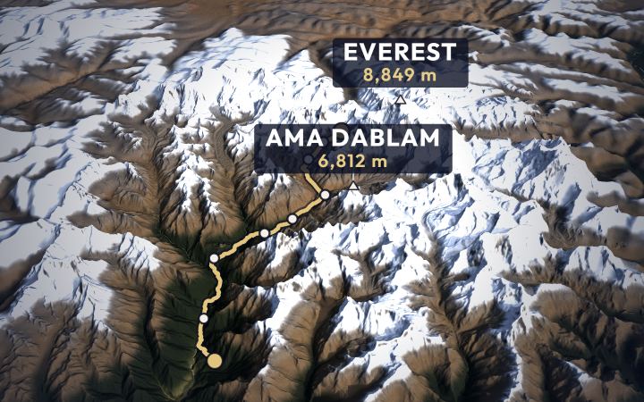
Everest Base Camp trek
It starts in Kathmandu, with a small plane and one of the most famous runways in the world. Then nine stops, about eight days up.
- Highest point
- Kala Patthar, 5,644 m (18,517 ft)
- Base camp
- 5,364 m (17,598 ft)
- Usually
- 12–14 days
- Best seasons
- Mar–May · Oct–Nov
- Starts at
- Lukla, 2,860 m (9,383 ft)
Day by day · 3D map · Book
-
Khumbu · Solukhumbu
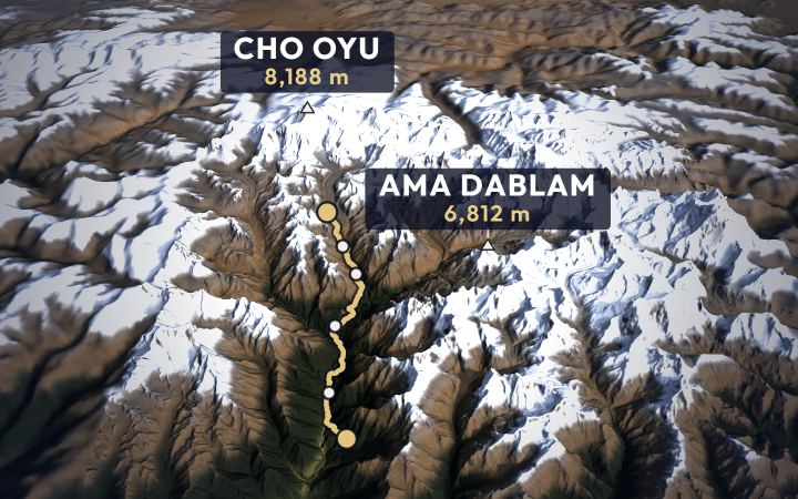
Gokyo Lakes trek
The same small plane to Lukla, the same climb to Namche, then north up a quieter valley to a chain of turquoise lakes under Cho Oyu.
- Highest point
- Gokyo Ri, 5,357 m (17,575 ft)
- Lakes
- about 4,700–4,800 m (15,748 ft)
- Usually
- 12–14 days
- Best seasons
- Mar–May · Oct–Nov
- Starts at
- Lukla, 2,860 m (9,383 ft)
Day by day · 3D map · Book
-
Khumbu · Solukhumbu
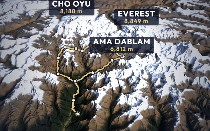
Everest Three Passes trek
A loop round the whole Khumbu: east to Everest Base Camp, west to the Gokyo lakes, three high passes in between and the old trading village of Thame on the way back.
- Highest point
- Kongma La, 5,535 m (18,159 ft)
- Start and finish
- Lukla
- Usually
- 18–21 days
- Best seasons
- Apr–May · Oct–Nov
Day by day · 3D map · Book
-
Khumbu · Solukhumbu
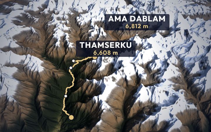
Everest Panorama trek
The flight to Lukla, the climb to Namche, the Sherpa villages above it and the monastery at Tengboche, with Everest in view. A week.
- From
- £880 per person
- Highest point
- Everest View Hotel, 3,880 m (12,730 ft)
- Start
- Lukla
- Usually
- 7–9 days
- Best seasons
- Mar–May · Oct–Dec
Day by day · 3D map · Book


Annapurna region
From Pokhara: Gurung villages, rhododendron forest and the Annapurna range.
-
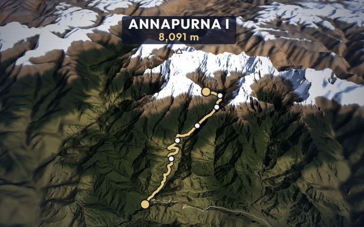
Annapurna Sanctuary · Kaski
Annapurna Base Camp trek
From Kathmandu by road to Pokhara, on to the trailhead at Nayapul, then about six days up into a ring of ice.
- From
- £750 per person
- Highest point
- Base camp, 4,130 m (13,550 ft)
- Start
- Nayapul, near Pokhara
- Usually
- 7–12 days
- Best seasons
- Mar–May · Oct–Nov
Day by day · 3D map · Book
-
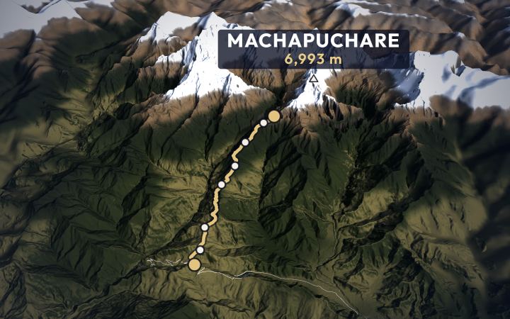
Annapurna · Kaski
Mardi Himal trek
From Kathmandu by road to Pokhara, up the Baglung road to Kande, then four days up a forested ridge to the foot of Machapuchare.
- From
- £650 per person
- Highest point
- Base camp, 4,500 m (14,764 ft)
- Start
- Kande, near Pokhara
- Usually
- 7–9 days
- Best seasons
- Mar–May · Oct–Nov
Day by day · 3D map · Book
-
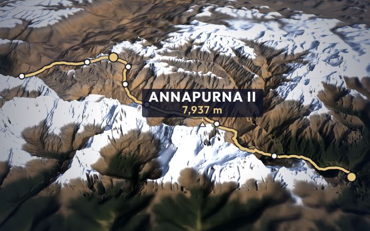
Manang · Mustang
Annapurna Circuit trek
From Kathmandu by road up the Marsyangdi, round the north side of the Annapurnas, over a pass at 5,416 m and down into Mustang.
- Highest point
- Thorong La, 5,416 m (17,769 ft)
- Start
- Dharapani, by road from Besisahar
- Usually
- 12–16 days
- Best seasons
- Mar–May · Oct–Nov
Day by day · 3D map · Book
-
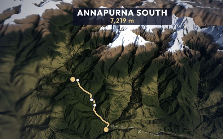
Annapurna · Myagdi and Kaski
Ghorepani Poon Hill trek
From Kathmandu to Pokhara, up the Baglung road to Nayapul, then three days up stone stairs through Magar villages and rhododendron forest to a sunrise over the Himalaya.
- From
- £540 per person
- Highest point
- Poon Hill, 3,210 m (10,531 ft)
- Start
- Nayapul, near Pokhara
- Usually
- 6–8 days
- Best seasons
- Mar–May · Oct–Dec
Day by day · 3D map · Book


Langtang region
The closest high valleys to Kathmandu, reached by road.
-
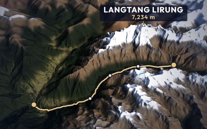
Langtang · Rasuwa
Langtang Valley trek
North from Kathmandu by road to Syabrubesi, then three days up a forested gorge into a wide glacier valley under Langtang Lirung.
- From
- £620 per person
- Highest point
- Tserko Ri (optional), 4,984 m (16,352 ft)
- Start
- Syabrubesi, by road from Kathmandu
- Usually
- 7–10 days
- Best seasons
- Mar–May · Oct–Nov
Day by day · 3D map · Book
-
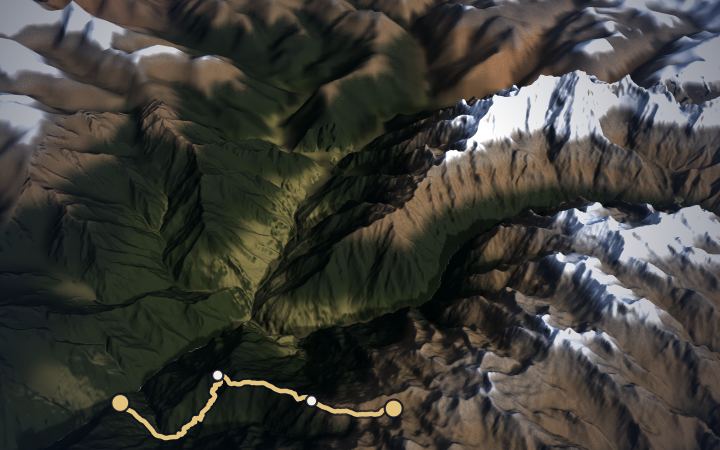
Langtang · Rasuwa
Gosaikunda trek
North from Kathmandu by road to Dhunche, then up a forested ridge to a chain of holy lakes at 4,380 m.
- From
- £490 per person
- Highest point
- Gosaikunda, 4,380 m (14,370 ft)
- Start
- Dhunche, by road from Kathmandu
- Usually
- 5–7 days
- Best seasons
- Mar–May · Oct–Nov
Day by day · 3D map · Book


Manaslu region
Restricted areas around the eighth-highest mountain, with fewer trekkers.
-
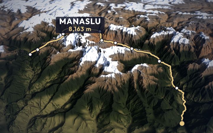
Gorkha · Manang
Manaslu Circuit trek
By road to the Budhi Gandaki, then two weeks round Manaslu: up the gorge into Tibetan Nubri, over the Larkya La at 5,106 m and down to the Marsyangdi.
- Highest point
- Larkya La, 5,106 m (16,752 ft)
- Start
- Machha Khola, by road from Kathmandu
- Usually
- 14–17 days
- Best seasons
- Mar–May · Sep–Nov
Day by day · 3D map · Book
-
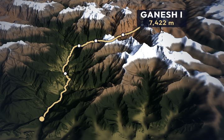
Gorkha · Chum Nubri
Tsum Valley trek
By road to the Budhi Gandaki, up the gorge past the Manaslu trail, then east into a hidden Buddhist valley on the Tibetan border.
- Highest point
- Mu Gompa, 3,700 m (12,139 ft)
- Start
- Machha Khola, by road from Kathmandu
- Usually
- 12–15 days
- Best seasons
- Mar–May · Sep–Nov
Day by day · 3D map · Book


Mustang region
The old kingdom of Lo: dry, wind-cut canyons and walled villages north of the Annapurnas, in the rain shadow.
-
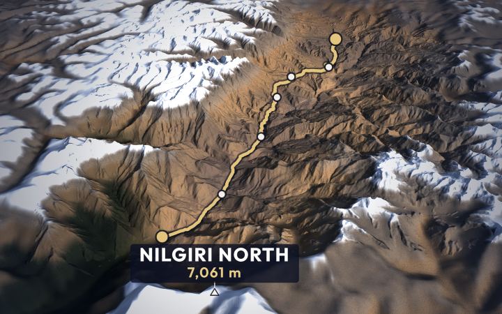
Mustang · Lo
Upper Mustang trek
To Pokhara, a dawn flight up what is often called the deepest gorge in the world to Jomsom, then a week north through the high desert to the walled city of Lo Manthang.
- Highest point
- Chogo La, about 4,200 m (13,780 ft)
- Start
- Jomsom, by air from Pokhara
- Usually
- 12–15 days
- Best seasons
- Mar–Nov
Day by day · 3D map · Book

Dolpo region
Remote Karnali behind the Dhaulagiri range, reached by small-plane flights: high passes and Tibetan Buddhist villages.
-
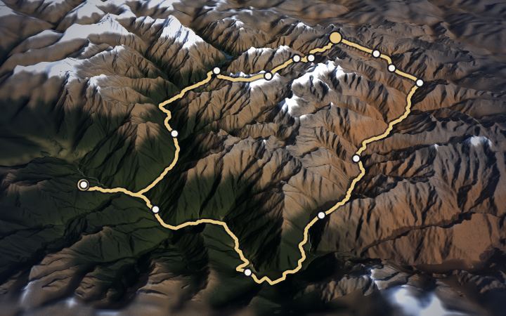
Dolpa · Karnali
Lower Dolpo trek
Two flights west, to Nepalgunj and up to the airstrip at Juphal. Then the Tarap gorge, two passes over 5,100 m and the turquoise of Phoksundo Lake.
- Highest point
- Numa La, 5,190 m (17,028 ft)
- Start and finish
- Juphal
- Usually
- 16–19 days
- Best seasons
- May–Jun · Sep–Oct
Day by day · 3D map · Book

Kanchenjunga region
The far east of Nepal: long, remote and wild, under the third-highest mountain.
-
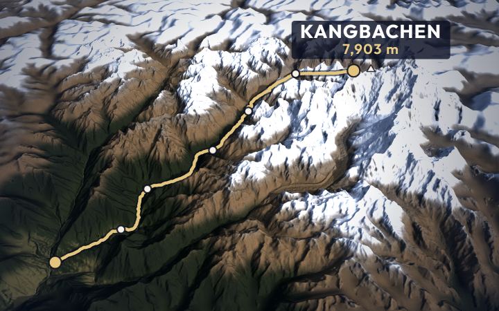
Taplejung · Koshi
Kanchenjunga Base Camp trek
East across Nepal by air and road to Taplejung, then up the Tamor and Ghunsa valleys to Pangpema, under the north face of Kangchenjunga.
- Highest point
- Pangpema, 5,143 m (16,873 ft)
- Start
- Sekathum, by road from Taplejung
- Usually
- 18–22 days
- Best seasons
- Mar–May · Oct–Nov
Day by day · 3D map · Book

Last updated 18 November 2026.